Geospatial Commission
MINING
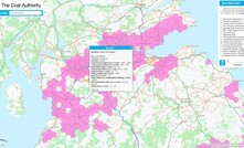
UK's Coal Authority frees up data for the public sector
Public sector organisations are now able to license the UK's Coal Authority data for free
30 April 2024
SITE INVESTIGATION
Construction Playbook updates will help to optimise ground investigation
An explanation of how ground investigation data will now be collected and curated by the BGS
12 October 2022
GROUNDWATER
Safety map will pinpoint UK's million miles of pipes and cables
UK national underground utility mapping introduced to increase worker safety
05 July 2021
INFRASTRUCTURE
Map of underground pipes and cables planned by UK government
Ambitious plans unveiled by UK government to prevent damage to underground utilities
08 May 2019
PARTNER CONTENT
Massenza Drilling Rigs new Mi45 model on double and oscillating crawler chassis
Mi45 drill rig for water wells for an Italian company producing chemicals.
PARTNER CONTENT
Introducing IQIP's fully integrated Vibro-Hydrohammer combination
IQIP is proud to announce the launch of its newest Vibro-Hydrohammer solution
PARTNER CONTENT
Resource Estimation: Accelerating Outcomes with Subsurface Modelling
Mineral exploration needs increasingly advanced tools to improve efficiency, accuracy
PARTNER CONTENT
Mineral exploration: gaining efficiencies with innovation and local expertise
Amid the energy transition, the exploration drilling space is set for new opportunities
THE ASPERMONT BRAND PORTFOLIO


Copyright © 2025 Aspermont Media Ltd. All rights reserved. Aspermont Media is a company registered in England and Wales. Company No. 08096447. VAT No. 136738101. Aspermont Media, WeWork, 1 Poultry, London, England, EC2R 8EJ.