geological visualisation
MINING
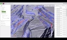
GeoSpatial Manager introduced by Maptek
A new visualisation tool for miners and civil engineers was introduced by Maptek during Geoweek 2024
16 February 2024
GEOTECHNICAL & GEO-ENVIRONMENTAL
BGS releases free-to-access 3D underground regional models
Interactive 3D underground visualisations of the UK released by the British Geological Survey
08 February 2019
PARTNER CONTENT
Massenza Drilling Rigs new Mi45 model on double and oscillating crawler chassis
Mi45 drill rig for water wells for an Italian company producing chemicals.
PARTNER CONTENT
Introducing IQIP's fully integrated Vibro-Hydrohammer combination
IQIP is proud to announce the launch of its newest Vibro-Hydrohammer solution
PARTNER CONTENT
Resource Estimation: Accelerating Outcomes with Subsurface Modelling
Mineral exploration needs increasingly advanced tools to improve efficiency, accuracy
PARTNER CONTENT
Mineral exploration: gaining efficiencies with innovation and local expertise
Amid the energy transition, the exploration drilling space is set for new opportunities
THE ASPERMONT BRAND PORTFOLIO


Copyright © 2025 Aspermont Media Ltd. All rights reserved. Aspermont Media is a company registered in England and Wales. Company No. 08096447. VAT No. 136738101. Aspermont Media, WeWork, 1 Poultry, London, England, EC2R 8EJ.